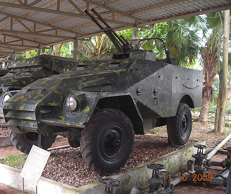
As part of his job Modern Forces team member Jack Krull often visits Vietnam and during is last trip he took these photos as the Ho Chi Minh Trail Museum.
The Ho Chi Minh Trail, known to the North Vietnamese as the Troung Son Strategic Supply Route, was not the image typically depicted by the media—an unsophisticated, haphazard series of small dirt roads built with the help of patriotically dedicated men and women. North Vietnamese conscripts built and maintained the trail, assisted by conscripts from Laos and Cambodia. Military service was mandatory in North Vietnam, and there was no such thing as
antiwar demonstrations or activities.
The Ho Chi Minh Trail was estimated by U.S. intelligence to be 3,500 miles in length, stretching from southern North Vietnam into Laos, Cambodia, and finally the delta area south of Saigon, the capital of what was South Vietnam. After the war, the North Vietnamese would admit that the trail was actually 8,100 miles long. In Laos alone, it
encompassed an estimated 1,700 square miles and included a sophisticated logistics network made up of major routes, roads, trails, vehicle parks, petroleum pipelines, and storage and bivouac areas.
The North Vietnamese and their allies built this sophisticated system, in flagrant violation of international treaties and with complete disregard for international borders, in 1959. In 1965, U.S. intelligence estimated that 3,000 North Vietnamese per month were using the trail to infiltrate Laos. In 1961, at a conference in Geneva, Switzerland, the United States and North Vietnam (among other countries) signed an agreement guaranteeing the neutrality of Laos. North Vietnam had no intention of keeping this promise, however, and continued using the trail to send men and materiel into Laos as well as Cambodia and South Vietnam.1 Intelligence estimates placed close to 100,000 North Vietnamese in Laos and Cambodia for network maintenance and protection. Also suspected of being stationed in Laos were an estimated 14,000 to 15,000 Communist Chinese. From 3,000 to 5,000 of these troops were specifically dedicated to antiaircraft weaponry operations and maintenance and the rest to road construction and maintenance.
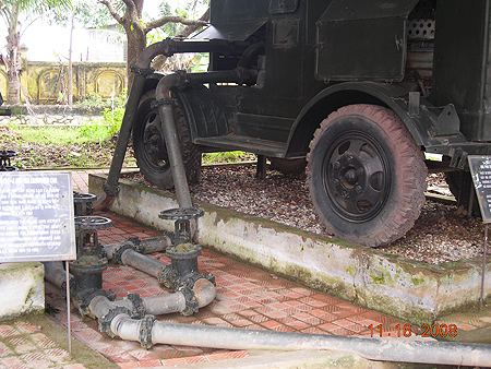
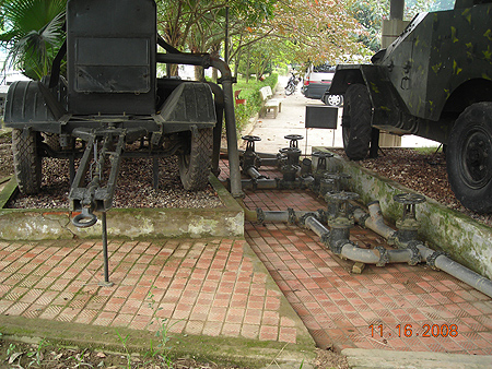
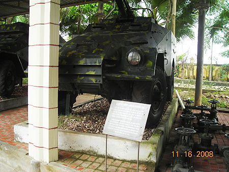
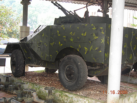
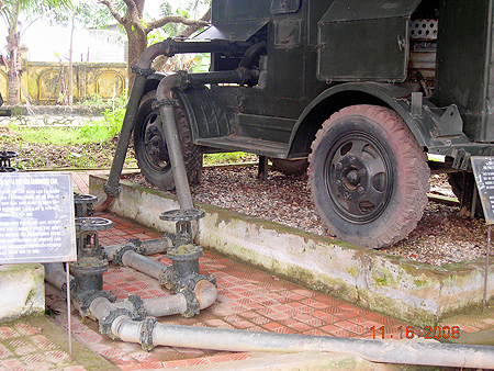
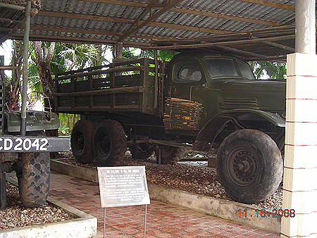
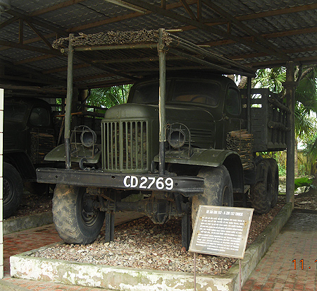
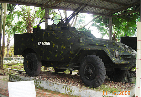
According to PAVN General Tran Tien Dung "We laid 3,125 miles of pipeline through deep rivers and streams and over mountains more than 3,000 feet high. We were capable of providing enough fuel for the various battlefronts. We put more than 10,000 transportation vehicles on the Trail". The existence of the pipeline was proven by SOG teams and elements of this pipeline can be seen in the photos on this page along with a ZiS-151 truck and a Russian BTR-40 or Type 55 (Chinese copy of BTR-40) armoured car.
|
